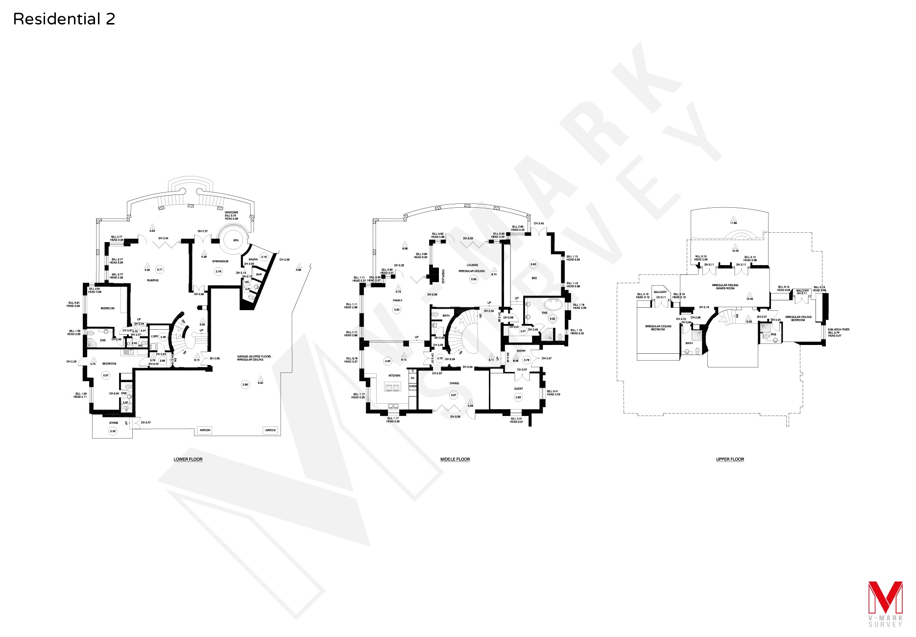
Our Services
Our Services
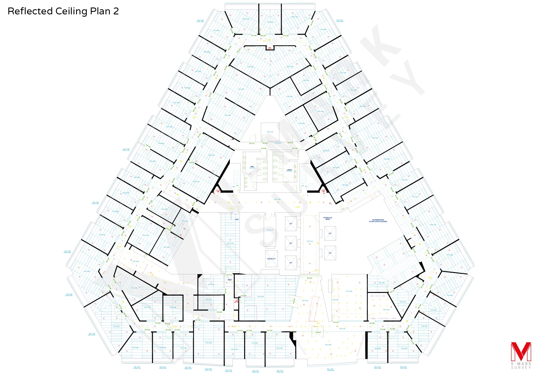
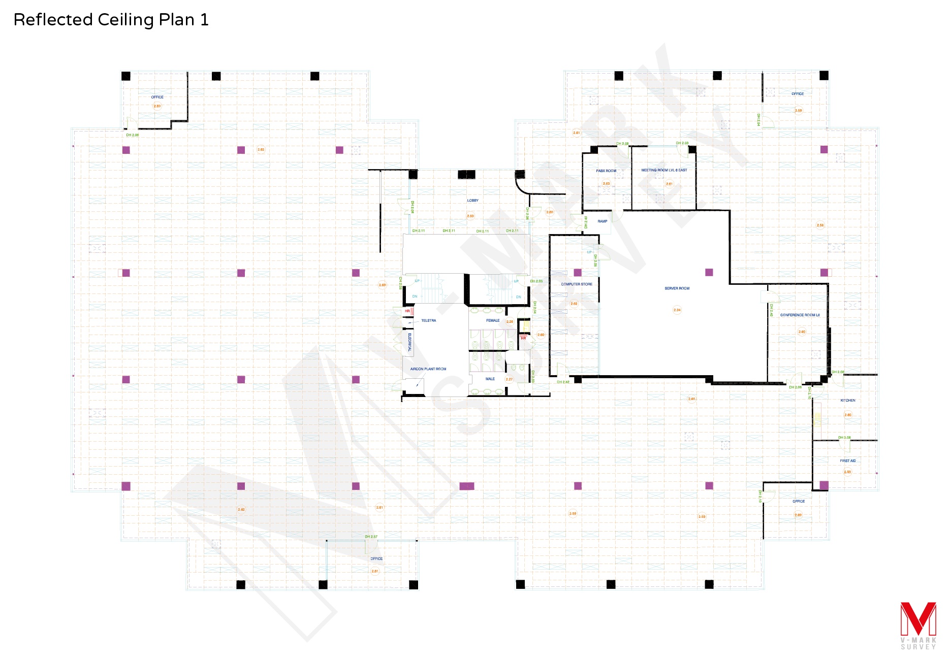
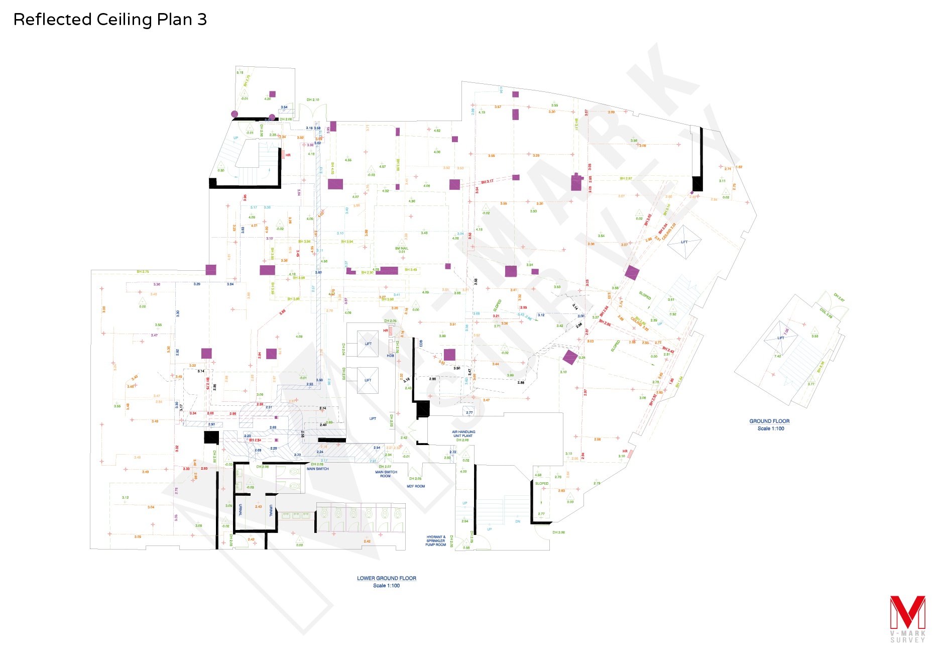
REFLECTED CEILING PLANS
V-Mark Survey produces accurate reflected ceiling plans (RCPs) that show the location of structural elements, features and services that are located on the ceiling or within the cavity above. When carrying out alterations and additions, these drawings are invaluable to architects and engineers for accurate design and implementation of mechanical, electrical & fire systems, lighting, ceiling grids and partitions.
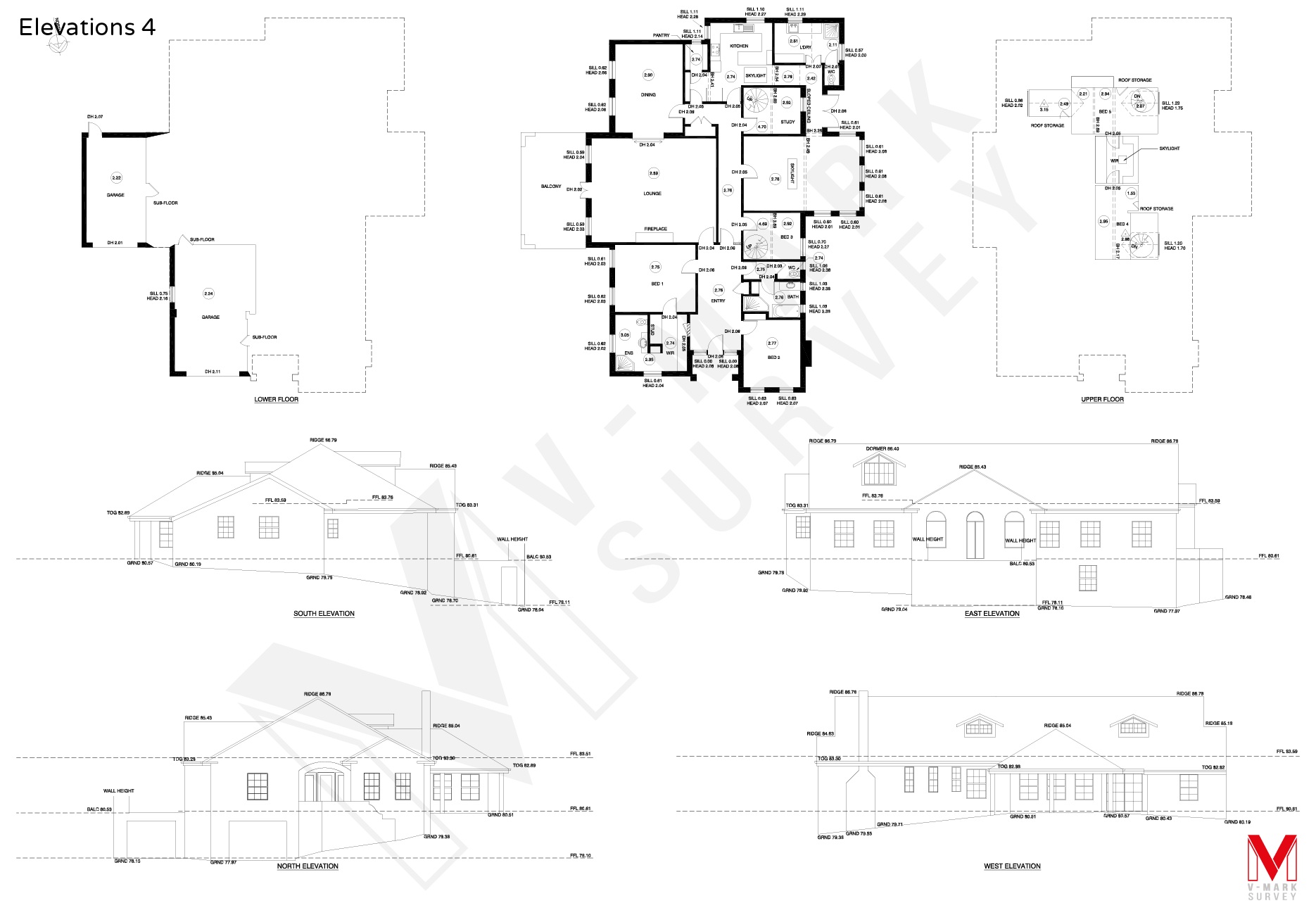
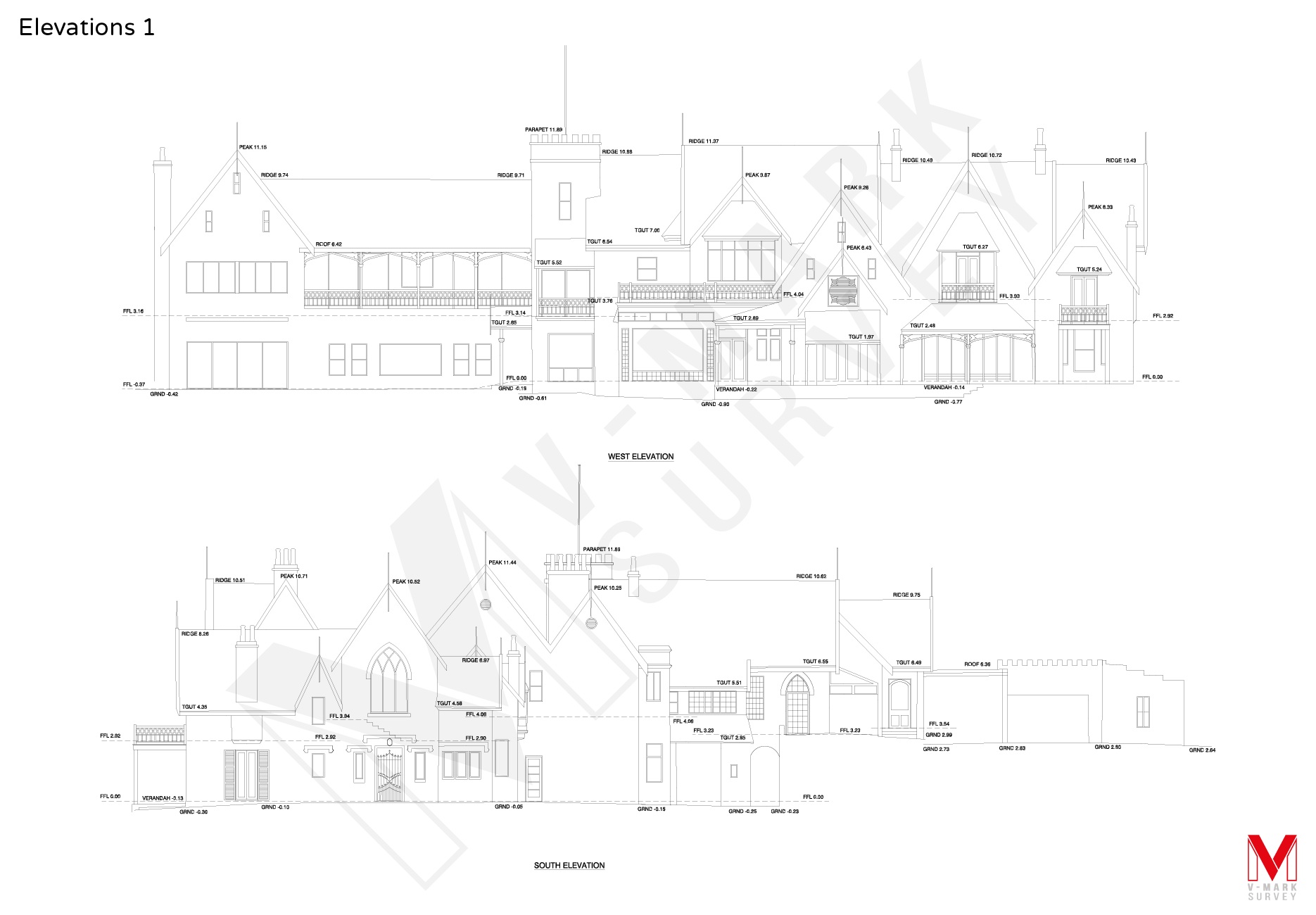
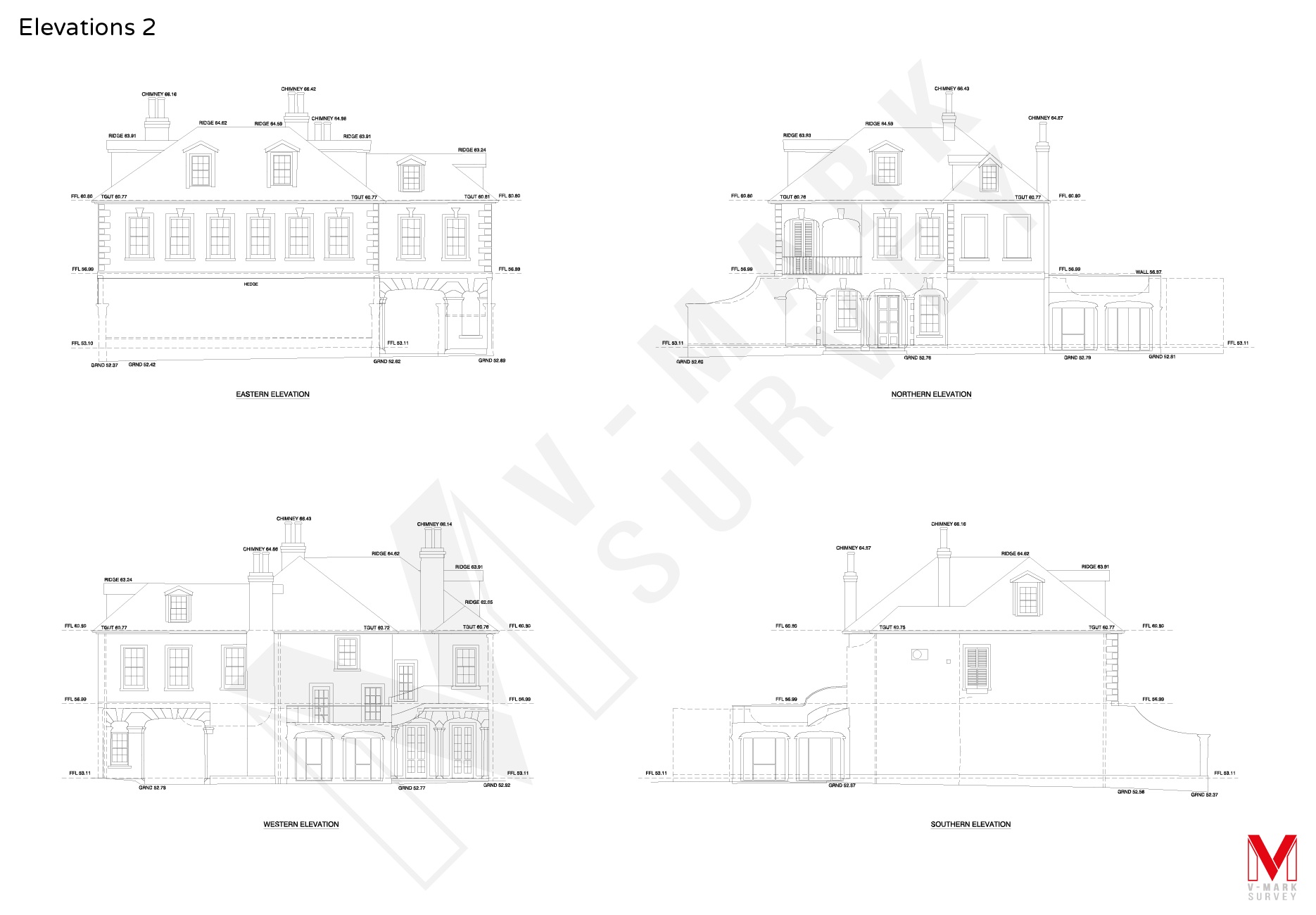
ELEVATION SURVEYS
Façade or elevation surveys accurately represent the features on the external facades of a building including walls, doors, windows, roofs and other structural elements. The team at V-Mark Survey are experts in preparing measured elevation drawings for Development Applications and renovation projects.
Learn more about our Architectural Elevations Drawing and Elevation Survey Services.
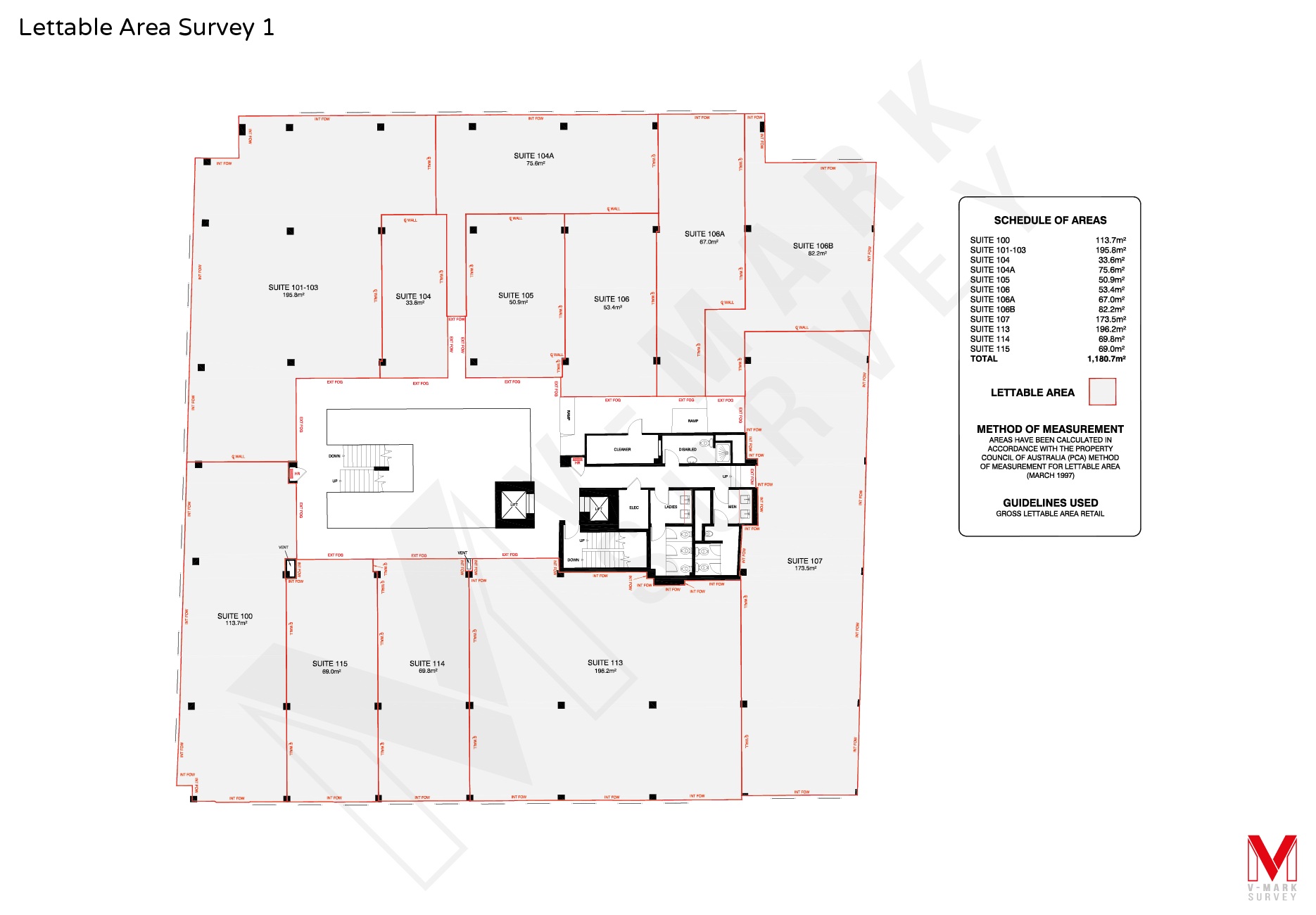
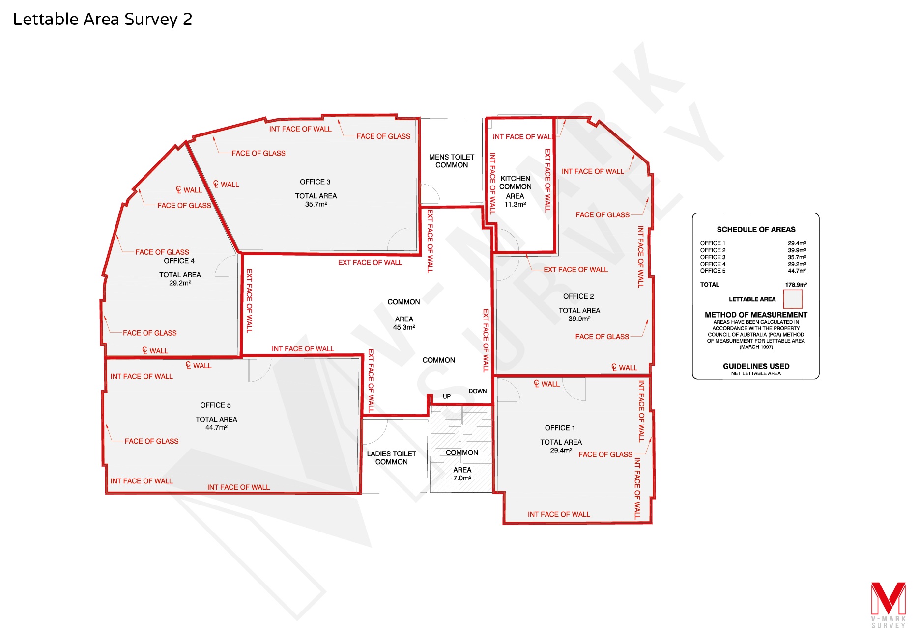
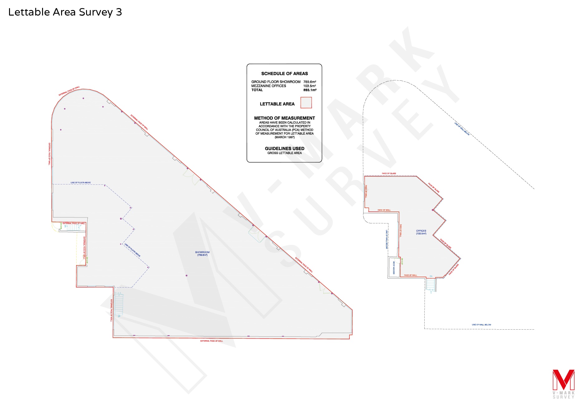
LETTABLE AREA SURVEYS
Lettable area surveys are performed in order to determine the exact area of offices, shops and commercial and industrial space for letting or rental purposes.
Our Gross Lettable Area (for retail/industrial tenancies) and Net Lettable Area (for commercial tenancies) surveys are conducted in accordance with the method of measurement set out by the Property Council of Australia. A plan illustrating areas of each tenant’s space is prepared by our experienced surveyors, providing you with the most accurate measurements possible in order to avoid disputes over rental rates or areas quoted.
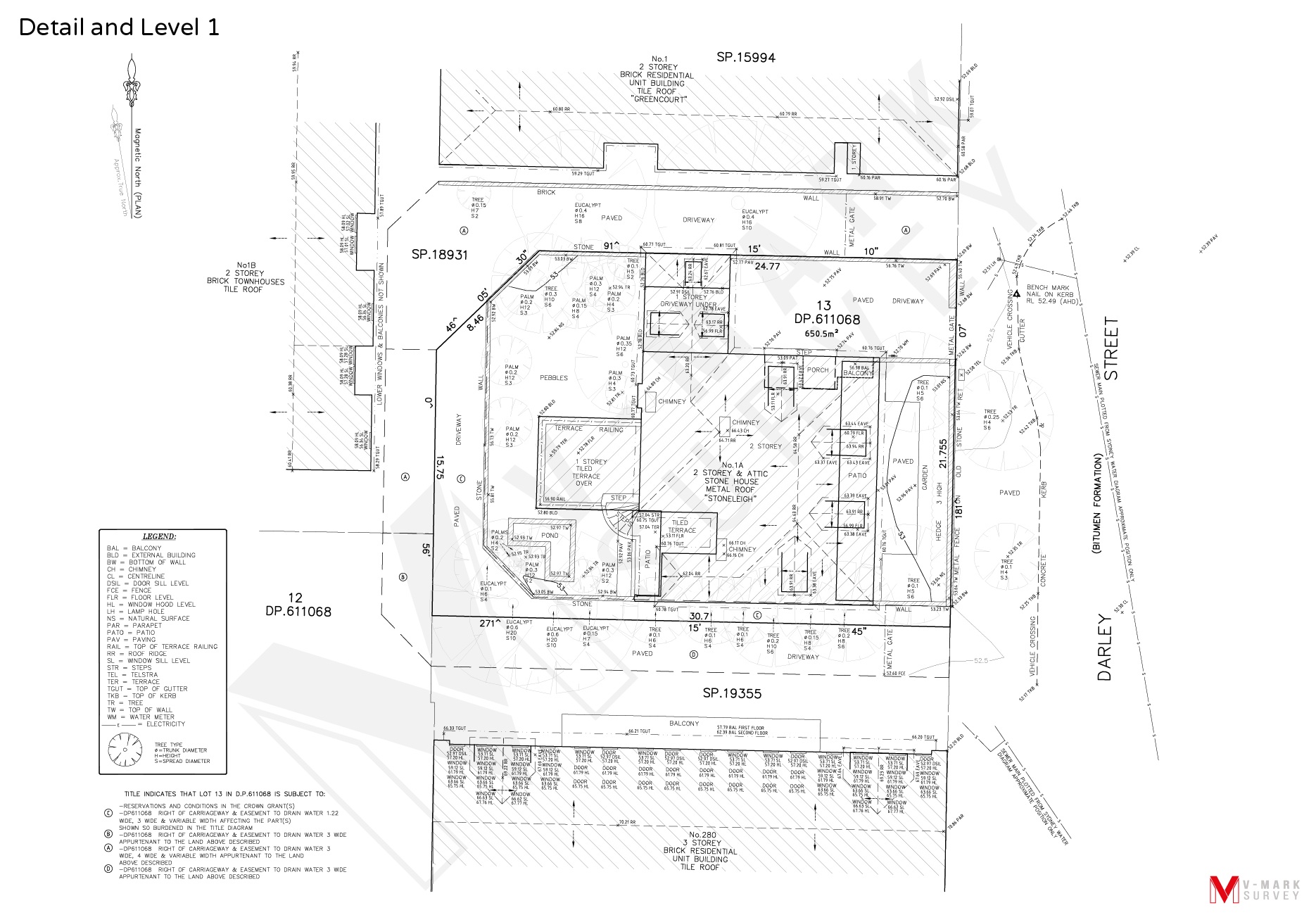
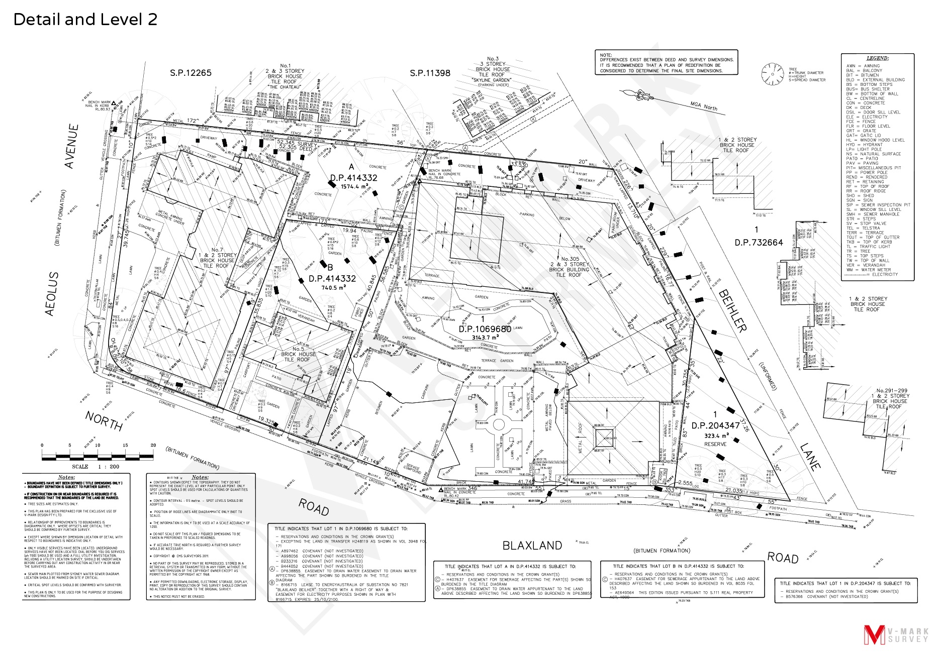
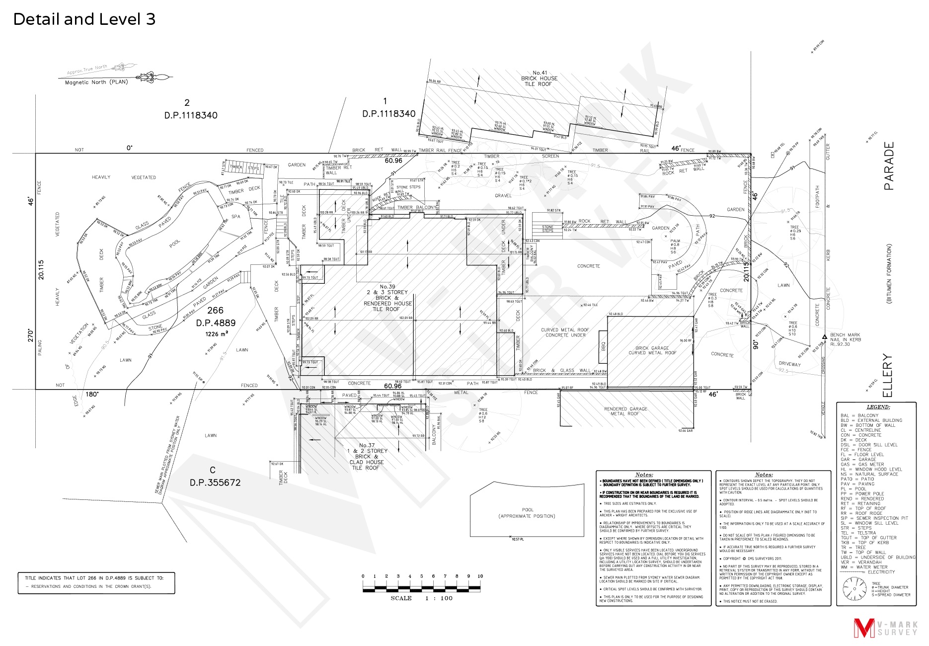
DETAIL AND LEVEL SURVEYS
Also referred to as topographical surveys, detail and level plans show the levels and features of the land, the location of trees, rocks, adjoining buildings and other structures and improvements on a given site. Detail and level surveys are typically required for council Development Applications. Architects and designers can use this information for compliant and economical design, accessibility for people and vehicles and to determine and utilise any unique features the land may have.
Our plans are drawn to scale and include the contours of the land as well as the dimensions and orientation of the boundaries to north. Our plans also show easements, right of ways and the position of sewer mains and services. We deliver your quality detail and level survey in formats such as traditional hard copy, PDF or AutoCAD.